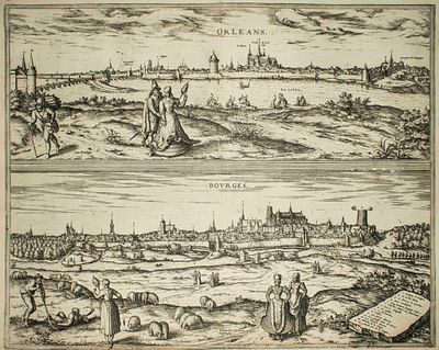
Frans Hogenberg Georg Braun - Orleans and Bourges - Etching on paper (1575)
Estimate: £300 - £400
Braun G., Hogenberg F., "Orleans, Bourges", from the collection "Civitates Orbis Terrarum", Cologne, T. Graminaeus, 1572-1617. Image Dim: cm 37 x 46.5 Dim: cm 40.5 x 53.5.
Interesting B/W Aquatint showing an Antique View of Orléans and Bourges, on the shore of the rivers: Loire and Auron. Well visible, the Holy Cross Cathedral, destroyed during the wars of religion in 1568 and subsequently rebuilt by Henry IV in 1600. Very Good conditions, with some light stains on margins.
The “Civitates Orbis Terrarum” (Atlas of Cities of the World) was the second oldest printed atlas in the history of world cartography and the first atlas totally dedicated to topographical views. The first volume of this collection was published at Cologne in 1572; the others following in 1575, 1581, 1588 and 1598. The sixth and final volume appeared in 1617, just before the extensive devastation wreaked by the Thirty Years’War.
“The most original and magnificent of all city-atlases, which drew on the work of accomplished topographical artists; and…reproduced it in pictorial compositions of great charm and individuality”. R.A.Skelton